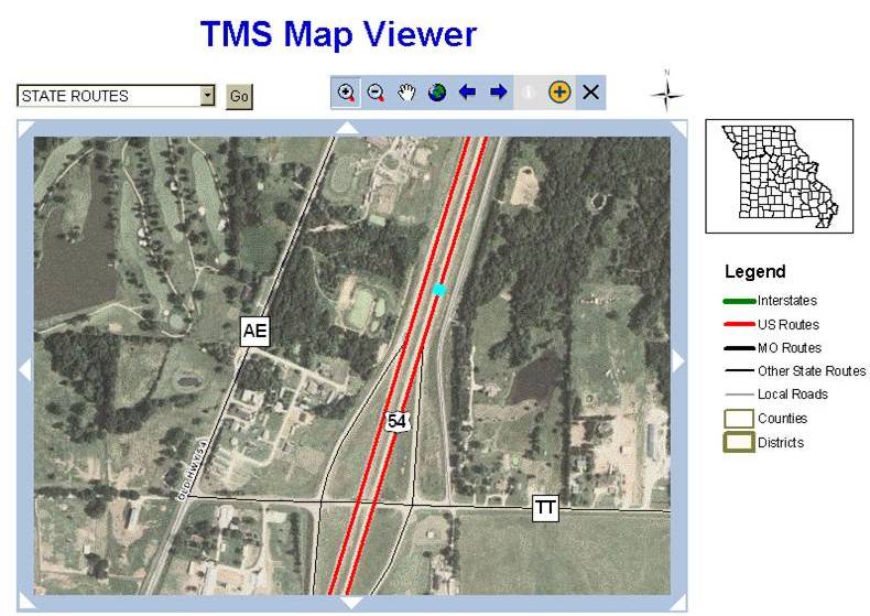
Spatial Referencing System
- Reference data using gis coordinates.
- Data analysis by location.
- Real-time data with Optimal performance.
- Uses Location and Linear references to relate data instead of physical relationships used in a relational database.
- Graphical User Interface used to apply roadway edits into the Oracle TMS transactional database.
- Data is located using known points:
- Intersections
- Bridges
- County Boundaries
- City Limits
- Urban Limits
- Log Miles
About Us
ANSRWARE was founded by a group of IT professionals with experience over the last 3 decades in designing, developing and implementing computer systems in a wide range of industries that include: Insurance, Transportation, Health Insurance, Retail, Technology and State Government The ANSRWARE staff has a proven track record of implementing successful systems in Fortune 500 companies and Government Agencies that include: Texas Instruments, American Airlines, Exxon Mobile, Kaiser Permanente, Target, JC Penney, Departments of Transportation, Health, Social Services (need the big companies employees have worked for?) ANSRWARE staff has extensive Information Technology experience in the areas of Web Site Development, Database Design, Computer Systems Design, System Development, System Implementation, System Integration , System Support and System Hosting on various Internet and custom platforms. ANSRWARE has the experience to successfully develop, implement and support your enterprise software applications.
Contact Us
Copyright © 2008-2021 ANSRWARE
Copyright © 2008-2021 ANSRWARE
Terms of Use Privacy Policy
Terms of Use Privacy Policy